Germany: LiDAR Innovation for Solar Energy
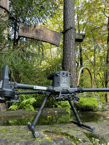
Drones Maritime executed high-precision LiDAR scanning projects in Germany for Sonnedix, subcontracted by Aeromedia. These initiatives supported the design and development of solar farms using Phoenix LiDAR systems, mounted on a DJI Matrice 350 RTK drone, connected to SAPOS GNSS services to obtain the highest quality georeferenced data.
In addition, ground control points were established using Leica RTK GPS, ensuring the fidelity of the mapping data obtained. The operations were carried out in coordination with DFS Deutsche Flugsicherung GmbH, in strict compliance with German aviation safety regulations. This project represents a significant step forward in the integration of innovative technologies for the development of clean energy in Germany.
Innovation and challenges overcome
Modern Energy Infrastructures: LiDAR data contributed to the development of highly efficient solar parks.
Energy Sustainability: This project supports Germany's climate goals by accelerating the transition to renewable sources.
Operational Efficiency: The accuracy of the data enabled faster and smoother design.
Impact and benefits
Regulatory Compliance: We coordinate flights with DFS Deutsche Flugsicherung GmbH in strict compliance with local regulations.
Weather Conditions: We adapt our operations to weather challenges to maintain data consistency.
Overcoming Logistical Obstacles: We ensure the efficient transport of drones and equipment classified as hazardous materials.
Location
Germany