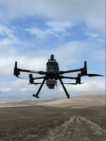
Hungary: LiDAR Technology Applied to Solar Farms
In Hungary, Drones Maritime participated in LiDAR scanning projects for Sonnedix, subcontracted by Aeromedia, providing critical data for the development of solar parks in the country. The operations employed Phoenix LiDAR systems, integrated into a DJI Matrice 350 RTK drone, which was connected to the Kozmikus Geodéziai Obszervatórium to ensure real-time accuracy of the measurements.
The team also used Leica RTK GPS to establish ground control points, which improved the accuracy of the mapping of the sites. All aerial operations were carefully coordinated with the Hungarian Civil Aviation Authority (Hungarian CAA), complying with local regulations. This project has been a key step in the growth of the renewable energy sector in Hungary, supporting the expansion of solar parks in the country.
Innovation and challenges overcome
Facilitating Solar Development: The data collected optimised the design and planning of critical solar infrastructures.
Regional Connection: This project strengthens the expansion of renewable sources in Eastern Europe.
Cost Reduction: Thanks to drone technology, we eliminated the need for more costly and less accurate methods.
Impact and benefits
Aerial Management: We coordinated flights with the Hungarian Civil Aviation Authority (Hungarian CAA) to ensure safe and regulated operations.
High Accuracy: The use of drones and RTK GPS allowed us to capture detailed data in real time.
Location
Hungary